Faili:White and Blue Nile-en.svg

Size of this PNG preview of this SVG file: piseli 438 × 572. Ukubwa zingine: piseli 184 × 240 | piseli 367 × 480 | piseli 588 × 768 | piseli 784 × 1,024 | piseli 1,568 × 2,048.
Faili halisi (faili la SVG, husemwa kuwa piseli 438 × 572, saizi ya faili: 472 KB)
| Faili hili linatoka Wikimedia Commons. Maelezo yapo kule kwenye ukurasa wake wa maelezo unaonekana hapo chini.
|
| Maelezo | |
| Tarehe | (UTC) |
| Chanzo | |
| Mwandishi |
|
| Matoleo mengine |
|


I, the copyright holder of this work, hereby publish it under the following license:
This file is licensed under the Creative Commons Attribution-Share Alike 2.5 Generic, 2.0 Generic and 1.0 Generic license.
- Uko huru:
- kushiriki – kunakili na kusambaza kazi hiyo
- kwa remix – kurekebisha kazi
- Chini ya masharti yafuatayo:
- sifa – Ni lazima utoe mkopo unaofaa, utoe kiungo cha leseni, na uonyeshe ikiwa mabadiliko yalifanywa. Unaweza kufanya hivyo kwa njia yoyote inayofaa, lakini si kwa njia yoyote inayopendekeza mtoa leseni akuidhinishe wewe au matumizi yako.
Kumbukumbu ya upakizaji wa asili
This image is a derivative work of the following images:
- File:Nile-en.svg licensed with Cc-by-sa-2.5,2.0,1.0
- 2010-06-14T12:51:42Z Cryonic07 640x730 (756114 Bytes) {{Information |Description={{en|Map of the [[:en:Nile|Nile]] river.}} |Source=*[[:File:African_continent-en.svg|]] |Date=2010-06-14 12:46 (UTC) |Author=*[[:File:African_continent-en.svg|]]: *derivative work: [[User:Bobarino|B
Uploaded with derivativeFX
Historia ya faili
Bonyeza tarehe/saa kuona faili kama ilivyoonekana wakati huo.
| Tarehe/Saa | Picha ndogo | Vipimo | Mtumiaji | Maelezo | |
|---|---|---|---|---|---|
| sasa hivi | 18:09, 6 Agosti 2013 | | 438 × 572 (472 KB) | Hel-hama | northern section of map cropped |
| 17:53, 6 Agosti 2013 |  | 438 × 802 (472 KB) | Hel-hama | Improved version of map to include lower Nile | |
| 04:00, 20 Septemba 2011 |  | 365 × 480 (627 KB) | Alphathon | Added South Sudan using borders from File:South_Sudan-CIA_WFB_Map.png | |
| 11:11, 15 Juni 2010 |  | 365 × 480 (741 KB) | Cryonic07 | font size | |
| 09:28, 15 Juni 2010 |  | 365 × 480 (741 KB) | Cryonic07 | Italics. Lake Tana, Khartoum, Juba and Jinja marked | |
| 19:17, 14 Juni 2010 |  | 365 × 480 (736 KB) | Cryonic07 | Tanzania was not marked on the map | |
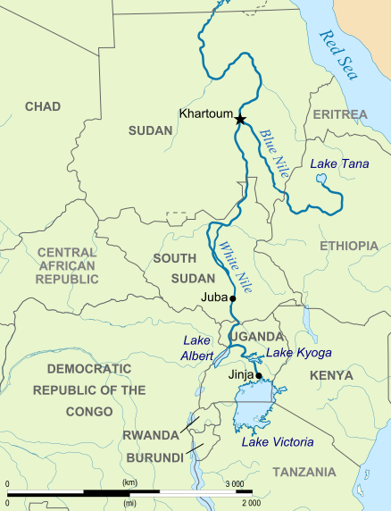
| 13:56, 14 Juni 2010 |  | 365 × 480 (734 KB) | Cryonic07 | {{Information |Description={{en|Map showing the White Nile and the Blue Nile}} |Source=*File:Nile-en.svg |Date=2010-06-14 13:32 (UTC) |Author=*File:Nile-en.svg: *[[:File:African_continent-en.svg|African_con |
Matumizi ya faili
Ukurasa huu umeunganishwa na faili hili:
Matumizi ya faili ulimwenguni
Wiki nyingine hutumia faili hizi:
- Matumizi kwa af.wikipedia.org
- Matumizi kwa ast.wikipedia.org
- Matumizi kwa ba.wikipedia.org
- Matumizi kwa br.wikipedia.org
- Matumizi kwa ca.wikipedia.org
- Matumizi kwa da.wikipedia.org
- Matumizi kwa de.wikipedia.org
- Matumizi kwa el.wikipedia.org
- Matumizi kwa en.wikipedia.org
- Matumizi kwa eo.wikipedia.org
- Matumizi kwa fa.wikipedia.org
- Matumizi kwa fo.wikipedia.org
- Matumizi kwa fr.wikipedia.org
- Matumizi kwa hu.wikipedia.org
- Matumizi kwa id.wikipedia.org
- Matumizi kwa ilo.wikipedia.org
- Matumizi kwa ja.wikipedia.org
- Matumizi kwa kn.wikipedia.org
- Matumizi kwa lv.wikipedia.org
- Matumizi kwa ml.wikipedia.org
- Matumizi kwa nl.wikipedia.org
- Matumizi kwa no.wikipedia.org
- Matumizi kwa pl.wikipedia.org
- Matumizi kwa ru.wikipedia.org
- Matumizi kwa sh.wikipedia.org
- Matumizi kwa sk.wikipedia.org
- Matumizi kwa sr.wikipedia.org
- Matumizi kwa ta.wikipedia.org
- Matumizi kwa uz.wikipedia.org
- Matumizi kwa yi.wikipedia.org
- Matumizi kwa zh.wikipedia.org