Faili:GoodenoughIslandTopography.png

Ukubwa wa hakikisho: piseli 657 × 600. Ukubwa zingine: piseli 263 × 240 | piseli 526 × 480 | piseli 841 × 768 | piseli 1,122 × 1,024 | piseli 1,398 × 1,276.
Faili halisi (piseli 1,398 × 1,276, saizi ya faili: 312 KB, aina ya MIME: image/png)
| Faili hili linatoka Wikimedia Commons. Maelezo yapo kule kwenye ukurasa wake wa maelezo unaonekana hapo chini.
|
Muhtasari
| Maelezo |
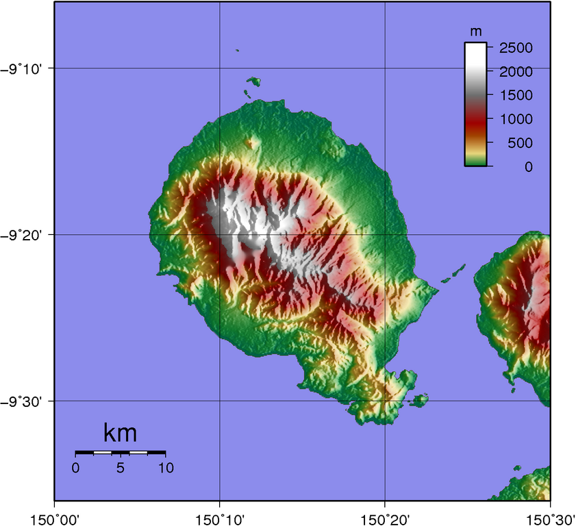
Topographic map of Goodenough Island SRTM data has lots missing data up in the mountains... |
| Tarehe | |
| Chanzo | Created with GMT from publicly available SRTM data |
| Mwandishi | Sadalmelik |
Hatimiliki
| I, the copyright holder of this work, release this work into the public domain. This applies worldwide. Katika nchi zingine hii haiwezekani kisheria; kama ni hivyo: I grant anyone the right to use this work for any purpose, without any conditions, unless such conditions are required by law. |
Historia ya faili
Bonyeza tarehe/saa kuona faili kama ilivyoonekana wakati huo.
| Tarehe/Saa | Picha ndogo | Vipimo | Mtumiaji | Maelezo | |
|---|---|---|---|---|---|
| sasa hivi | 11:31, 2 Juni 2007 | | 1,398 × 1,276 (312 KB) | Sadalmelik | |
| 20:56, 1 Juni 2007 |  | 1,398 × 1,276 (304 KB) | Sadalmelik | {{Information |Description=Topographic map of Goodenough Island SRTM data has lots missing data up in the mountains... |Source=Created with GMT from publicly available SRTM data |Date=1st June 2007 |Author= User:Sadalmelik }} [[Category:Maps of Papu |
Matumizi ya faili
Ukurasa huu umeunganishwa na faili hili:
Matumizi ya faili ulimwenguni
Wiki nyingine hutumia faili hizi:
- Matumizi kwa als.wikipedia.org
- Matumizi kwa arz.wikipedia.org
- Matumizi kwa ceb.wikipedia.org
- Matumizi kwa de.wikipedia.org
- Matumizi kwa el.wikipedia.org
- Matumizi kwa en.wikipedia.org
- Matumizi kwa es.wikipedia.org
- Matumizi kwa fa.wikipedia.org
- Matumizi kwa fr.wikipedia.org
- Matumizi kwa gl.wikipedia.org
- Matumizi kwa he.wikipedia.org
- Matumizi kwa it.wikipedia.org
- Matumizi kwa ka.wikipedia.org
- Matumizi kwa nl.wikipedia.org
- Matumizi kwa pnb.wikipedia.org
- Matumizi kwa pt.wikipedia.org
- Matumizi kwa ru.wikipedia.org
- Matumizi kwa vi.wikipedia.org
- Matumizi kwa www.wikidata.org
- Matumizi kwa zh.wikipedia.org