Faili:Gulf of Thailand.svg

Size of this PNG preview of this SVG file: piseli 488 × 479. Ukubwa zingine: piseli 245 × 240 | piseli 489 × 480 | piseli 782 × 768 | piseli 1,043 × 1,024 | piseli 2,086 × 2,048.
Faili halisi (faili la SVG, husemwa kuwa piseli 488 × 479, saizi ya faili: 387 KB)
| Faili hili linatoka Wikimedia Commons. Maelezo yapo kule kwenye ukurasa wake wa maelezo unaonekana hapo chini.
|
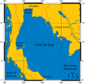
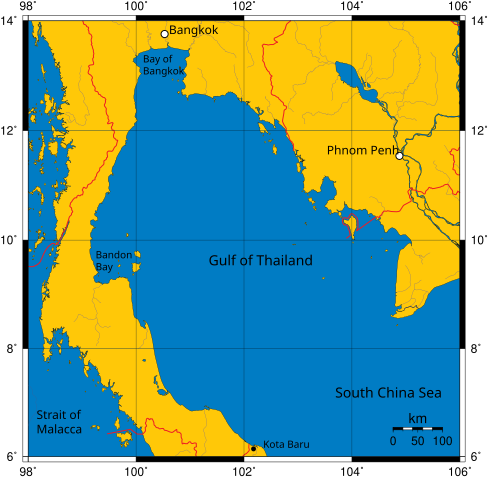
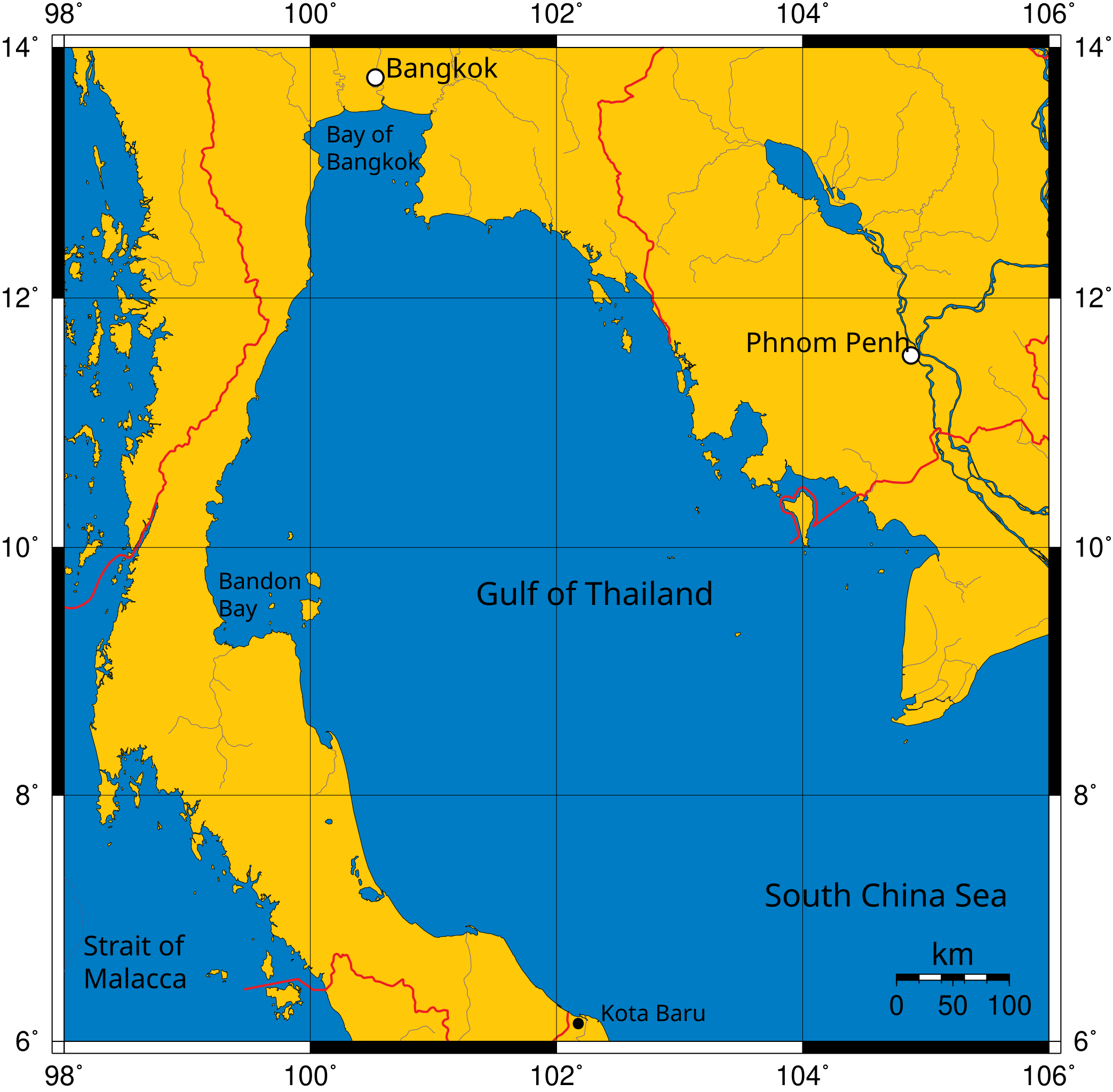
Mercator projection of Gulf of Thailand.
Public Domain map created by Online Map Creation:
http://www.aquarius.geomar.de/omc/omc_intro.html archive copy at the Wayback Machine
Modified by me (User:Feydey).
Other versions
-
 Italiano
 -
 Македонски
 -
 বাংলা
বাংলা


| This work has been released into the public domain by its author, User:Feydey. This applies worldwide. Katika nchi zingine hii haiwezekani kisheria; kama ni hivyo: User:Feydey grants anyone the right to use this work for any purpose, without any conditions, unless such conditions are required by law.
|
derivative works
Derivative works of this file:
Historia ya faili
Bonyeza tarehe/saa kuona faili kama ilivyoonekana wakati huo.
| Tarehe/Saa | Picha ndogo | Vipimo | Mtumiaji | Maelezo | |
|---|---|---|---|---|---|
| sasa hivi | 11:06, 16 Januari 2020 | | 488 × 479 (387 KB) | Paul 012 | The label "Andaman Sea" was in the area officially defined as the Strait of Malacca. |
| 17:53, 27 Juni 2007 |  | 488 × 479 (387 KB) | Feydey | Mercator projection of Gulf of Thailand. Public Domain map created by Online Map Creation: http://www.aquarius.geomar.de/omc/omc_intro.html Modified by me (User:Feydey). {{PD}} Category:Maps of seas |
Matumizi ya faili
Ukurasa huu umeunganishwa na faili hili:
Matumizi ya faili ulimwenguni
Wiki nyingine hutumia faili hizi:
- Matumizi kwa af.wikipedia.org
- Matumizi kwa azb.wikipedia.org
- Matumizi kwa br.wikipedia.org
- Matumizi kwa ca.wikipedia.org
- Matumizi kwa ckb.wikipedia.org
- Matumizi kwa da.wikipedia.org
- Matumizi kwa de.wikinews.org
- Matumizi kwa el.wikipedia.org
- Matumizi kwa en.wikipedia.org
- Matumizi kwa fa.wikipedia.org
- Matumizi kwa fi.wikipedia.org
- Matumizi kwa fr.wikipedia.org
- Matumizi kwa hi.wikipedia.org
- Matumizi kwa hu.wikipedia.org
- Matumizi kwa ilo.wikipedia.org
- Matumizi kwa io.wikipedia.org
- Matumizi kwa ja.wikipedia.org
- Matumizi kwa ka.wikipedia.org
- Matumizi kwa km.wikipedia.org
- Matumizi kwa ko.wikipedia.org
- Matumizi kwa la.wikipedia.org
- Matumizi kwa lo.wikipedia.org
- Matumizi kwa min.wikipedia.org
- Matumizi kwa ml.wikipedia.org
- Matumizi kwa mr.wikipedia.org
- Matumizi kwa ms.wikipedia.org
- Matumizi kwa mt.wikipedia.org
- Matumizi kwa my.wikipedia.org
- Matumizi kwa nn.wikipedia.org
- Matumizi kwa pa.wikipedia.org
- Matumizi kwa pnb.wikipedia.org
- Matumizi kwa simple.wikipedia.org
- Matumizi kwa sr.wikipedia.org
- Matumizi kwa sv.wikipedia.org
- Matumizi kwa ta.wikipedia.org
- Matumizi kwa th.wikipedia.org
- Matumizi kwa tl.wikipedia.org
- Matumizi kwa tr.wikipedia.org
- Matumizi kwa uk.wikipedia.org
- Matumizi kwa ur.wikipedia.org
- Matumizi kwa vi.wikipedia.org
- Matumizi kwa war.wikipedia.org
- Matumizi kwa xmf.wikipedia.org
Tazama matumizi zaidi ya kimataifa ya faili hii.