Faili:Illinois Locator Map.PNG
Hakuna saizi kubwa zaidi.
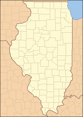
Illinois_Locator_Map.PNG (piseli 288 × 405, saizi ya faili: 12 KB, aina ya MIME: image/png)
| Faili hili linatoka Wikimedia Commons. Maelezo yapo kule kwenye ukurasa wake wa maelezo unaonekana hapo chini.
|

|
This locator map image could be re-created using vector graphics as an SVG file. This has several advantages; see Commons:Media for cleanup for more information. If an SVG form of this image is available, please upload it and afterwards replace this template with
{{vector version available|new image name}}.
It is recommended to name the SVG file “Illinois Locator Map.svg”—then the template Vector version available (or Vva) does not need the new image name parameter. |
Muhtasari
Hatimiliki
I, Ruhrfisch, the copyright holder of this work, hereby publishes it under the following licenses:

|
Ruhusa inakubalika kunakili, kusambaza na/au kurekebisha chini ya matakwa ya GNU Free Documentation License, Toleo 1.2 au toleo lolote lile la baadaye ambalo litachapishwa na Free Software Foundation; lisilo na Sehemu Tofauti, lisilo na Maandishi-Kava-Kwa-Mbele, na lisilo na Maandishi-Kava-Kwa -Nyuma. Nakala ya hatimiliki inajumlishwa kwenye sehemu ilioitwa GNU Free Documentation License. |
| Faili hii imeidhinishwa chini ya Creative Commons Attribution- Attribution-Share Alike 3.0 Unported leseni. | ||
| Sifa: I, Ruhrfisch | ||
shiriki sawa – Ukichanganya, kubadilisha, au kujenga juu ya nyenzo, lazima usambaze michango yako chini ya same or compatible license kama ya awali. | ||
| This licensing tag was added to this file as part of the GFDL licensing update. |
This file is licensed under the Creative Commons Attribution-Share Alike 2.5 Generic license.
Sifa: I, Ruhrfisch
- Uko huru:
- kushiriki – kunakili na kusambaza kazi hiyo
- kwa remix – kurekebisha kazi
- Chini ya masharti yafuatayo:
- sifa – Ni lazima utoe mkopo unaofaa, utoe kiungo cha leseni, na uonyeshe ikiwa mabadiliko yalifanywa. Unaweza kufanya hivyo kwa njia yoyote inayofaa, lakini si kwa njia yoyote inayopendekeza mtoa leseni akuidhinishe wewe au matumizi yako.
Unaweza kuchagua leseni ya chaguo lako.
This image or file is a work of a United States Census Bureau employee, taken or made as part of that person's official duties. As a work of the U.S. federal government, the image is in the public domain.
|
 |
Historia ya faili
Bonyeza tarehe/saa kuona faili kama ilivyoonekana wakati huo.
| Tarehe/Saa | Picha ndogo | Vipimo | Mtumiaji | Maelezo | |
|---|---|---|---|---|---|
| sasa hivi | 04:02, 25 Aprili 2007 | | 288 × 405 (12 KB) | Ruhrfisch | {{Information| |Description= Locator Map of Illinois, United States |Source= taken from US Census website [http://factfinder.census.gov/] and modified by User:Ruhrfisch |Date= March 2007 |Author= US Census, Ruhrfisch |Permission= US Census / US Gover |
| 03:45, 28 Machi 2007 |  | 288 × 405 (13 KB) | Ruhrfisch | {{Information| |Description= Locator Map of Illinois, United States |Source= taken from US Census website [http://factfinder.census.gov/] and modified by User:Ruhrfisch |Date= March 2007 |Author= US Census, Ruhrfisch |Permission= US Census / US Gover | |
| 03:12, 28 Machi 2007 |  | 242 × 412 (11 KB) | Ruhrfisch | {{Information| |Description= Locator Map of Illinois, United States |Source= taken from US Census website [http://factfinder.census.gov/] and modified by User:Ruhrfisch |Date= March 2007 |Author= US Census, Ruhrfisch |Permission= US Census / US Gover |
Matumizi ya faili
Kurasa hizi 37 zimeunganishwa na faili hili:
- Arlington Heights, Illinois
- Aurora, Illinois
- Berwyn, Illinois
- Blue Island, Illinois
- Bolingbrook, Illinois
- Burbank, Illinois
- Calumet City, Illinois
- Chicago Heights, Illinois
- Cicero, Illinois
- Country Club Hills, Illinois
- Countryside, Illinois
- Des Plaines, Illinois
- Elgin, Illinois
- Elmhurst, Illinois
- Evanston, Illinois
- Harvey, Illinois
- Hickory Hills, Illinois
- Hometown, Illinois
- Illinois
- Joliet, Illinois
- Markham, Illinois
- Maywood, Illinois
- Naperville, Illinois
- Northlake, Illinois
- Oak Forest, Illinois
- Oak Park, Illinois
- Palatine, Illinois
- Palos Heights, Illinois
- Palos Hills, Illinois
- Park Ridge, Illinois
- Prospect Heights, Illinois
- Rolling Meadows, Illinois
- Schaumburg, Illinois
- Skokie, Illinois
- Springfield, Illinois
- Waukegan, Illinois
- Kigezo:Mbegu-jio-Illinois
Matumizi ya faili ulimwenguni
Wiki nyingine hutumia faili hizi:
- Matumizi kwa ar.wikipedia.org
- Matumizi kwa ceb.wikipedia.org
- Matumizi kwa de.wikipedia.org
- Matumizi kwa en.wikipedia.org
- List of counties in Illinois
- List of protected areas of Illinois
- User talk:Kranar drogin/Archive 2
- Template:State parks of Illinois map
- User talk:Kranar drogin/Archive 3
- Wikipedia talk:WikiProject Illinois/Archive 3
- User:Ruhrfisch
- Template:Illinois County Labelled Map
- Module:Location map/data/USA Illinois inset/doc
- Module:Location map/data/USA Illinois inset
- User:Blåmerke
- Matumizi kwa fa.wikipedia.org
- فهرست شهرستانهای ایلینوی
- الگو:Geobox locator Illinois
- بیردزتاون، ایلینوی
- بلویل، ایلینوی
- بلویدر، ایلینوی
- بلومینگتون، ایلینوی
- بربنک، ایلینوی
- کانتون، ایلینوی
- کاربوندیل، ایلینوی
- کارتج، ایلینوی
- شمپین، ایلینوی
- چنوآ، ایلینوی
- کلینزویل، ایلینوی
- کیوبا، ایلینوی
- فریپورت، ایلینوی
- جلینا، ایلینوی
- گرانیتسیتی، ایلینوی
- گرینویل، ایلینوی
- هاروی، ایلینوی
- لانرک، ایلینوی
- لارنسویل، ایلینوی
- لاوز پارک، ایلینوی
- مارنگو، ایلینوی
- مونتکارول، ایلینوی
- مونتاسترلینگ، ایلینوی
- اورگان، ایلینوی
- پینکنویل، ایلینوی
- پولو، ایلینوی
Tazama matumizi zaidi ya kimataifa ya faili hii.