Faili:LocationCrimea.PNG

Ukubwa wa hakikisho: piseli 720 × 600. Ukubwa zingine: piseli 288 × 240 | piseli 576 × 480 | piseli 922 × 768 | piseli 1,200 × 1,000.
Faili halisi (piseli 1,200 × 1,000, saizi ya faili: 98 KB, aina ya MIME: image/png)
| Faili hili linatoka Wikimedia Commons. Maelezo yapo kule kwenye ukurasa wake wa maelezo unaonekana hapo chini.
|
| Maelezo |
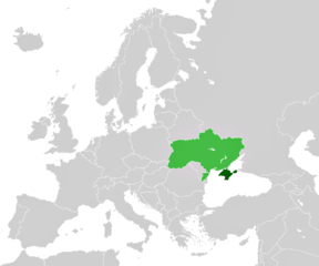
English: A map depicting location of Crimea (within Ukraine). |
|||
| Chanzo |
licenced as own work of the uploaders
|
|||
| Mwandishi | unstated, see "source" section for the uploaders | |||
| Ruhusa (Kutumia faili tena) |
|
|||
| Matoleo mengine |
|


Historia ya faili
Bonyeza tarehe/saa kuona faili kama ilivyoonekana wakati huo.
| Tarehe/Saa | Picha ndogo | Vipimo | Mtumiaji | Maelezo | |
|---|---|---|---|---|---|
| sasa hivi | 15:38, 27 Aprili 2011 | | 1,200 × 1,000 (98 KB) | ANGELUS | improved |
| 15:48, 4 Machi 2014 |  | 1,200 × 1,000 (98 KB) | CoArms | This map is LocationCrimea, not the Russian involvement in the Crimean crisis. |
Matumizi ya faili
Ukurasa huu umeunganishwa na faili hili:
Matumizi ya faili ulimwenguni
Wiki nyingine hutumia faili hizi:
- Matumizi kwa de.wikipedia.org
- Wikipedia:Hauptseite/Archiv/18. März 2014
- Wikipedia:Hauptseite/Archiv/19. März 2014
- Wikipedia:Hauptseite/Archiv/20. März 2014
- Wikipedia:Hauptseite/Archiv/21. März 2014
- Wikipedia:Hauptseite/Archiv/22. März 2014
- Wikipedia:Hauptseite/Archiv/23. März 2014
- Wikipedia:Hauptseite/Archiv/24. März 2014
- Wikipedia:Hauptseite/Archiv/25. März 2014
- Matumizi kwa fiu-vro.wikipedia.org
- Matumizi kwa pl.wikipedia.org
- Matumizi kwa sl.wikipedia.org
- Matumizi kwa su.wikipedia.org
- Matumizi kwa vi.wikipedia.org