Faili:Norway Counties Sogn og Fjordane Position.svg

Size of this PNG preview of this SVG file: piseli 562 × 600. Ukubwa zingine: piseli 225 × 240 | piseli 450 × 480 | piseli 719 × 768 | piseli 959 × 1,024 | piseli 1,918 × 2,048 | piseli 740 × 790.
Faili halisi (faili la SVG, husemwa kuwa piseli 740 × 790, saizi ya faili: 67 KB)
| Faili hili linatoka Wikimedia Commons. Maelezo yapo kule kwenye ukurasa wake wa maelezo unaonekana hapo chini.
|
| Maelezo |
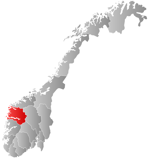
Autogenerated locator map of Norwegian county as named in filename. Exact copy needed at new filename for use in which automatically inserts maps and requires filename to match fylke name. |
| Tarehe | (UTC) |
| Chanzo | |
| Mwandishi |
|
| This is a retouched picture, which means that it has been digitally altered from its original version. The original can be viewed here: Norway Counties SognogFjordane Position.svg:
|
I, the copyright holder of this work, hereby publish it under the following license:
This file is licensed under the Creative Commons Attribution-Share Alike 2.5 Generic license.
- Uko huru:
- kushiriki – kunakili na kusambaza kazi hiyo
- kwa remix – kurekebisha kazi
- Chini ya masharti yafuatayo:
- sifa – Ni lazima utoe mkopo unaofaa, utoe kiungo cha leseni, na uonyeshe ikiwa mabadiliko yalifanywa. Unaweza kufanya hivyo kwa njia yoyote inayofaa, lakini si kwa njia yoyote inayopendekeza mtoa leseni akuidhinishe wewe au matumizi yako.
Kumbukumbu ya upakizaji wa asili
This image is a derivative work of the following images:
- File:Norway_Counties_SognogFjordane_Position.svg licensed with Cc-by-sa-2.5
- 2007-09-21T21:28:39Z Marmelad 256x256 (84333 Bytes) {{Information |Description=Autogenerated locator map of norwegian county as named in filename. |Source=Based on [[:Image:Norway counties blank.svg]] |Date=2007-09-21 |Author=[[User:marmelad|Marmelad]] |Permission=Own work, sh
Uploaded with derivativeFX
Historia ya faili
Bonyeza tarehe/saa kuona faili kama ilivyoonekana wakati huo.
| Tarehe/Saa | Picha ndogo | Vipimo | Mtumiaji | Maelezo | |
|---|---|---|---|---|---|
| sasa hivi | 08:25, 27 Januari 2019 | | 740 × 790 (67 KB) | Bjarkan | Border update (Rindal). |
| 03:06, 17 Desemba 2017 |  | 740 × 790 (67 KB) | Bjarkan | Improved version. | |
| 11:45, 24 Januari 2016 |  | 740 × 790 (81 KB) | Fleinn | Reverted to version as of 13:11, 16 August 2010 (UTC) | |
| 02:03, 19 Januari 2016 |  | 512 × 512 (82 KB) | Kingsocarso | Reverted to version as of 03:46, 6 April 2009 (UTC) | |
| 13:11, 16 Agosti 2010 |  | 740 × 790 (81 KB) | Fleinn | Added gradient. | |
| 03:46, 6 Aprili 2009 |  | 512 × 512 (82 KB) | AjaxSmack | {{Information |Description=Autogenerated locator map of Norwegian county as named in filename. Exact copy needed at new filename for use in en:Template:Infobox Fylke which automatically inserts maps and requires filename to match ''fylke'' name. |Sour |
Matumizi ya faili
Ukurasa huu umeunganishwa na faili hili:
Matumizi ya faili ulimwenguni
Wiki nyingine hutumia faili hizi:
- Matumizi kwa af.wikipedia.org
- Matumizi kwa ang.wikipedia.org
- Matumizi kwa ar.wikipedia.org
- Matumizi kwa ast.wikipedia.org
- Matumizi kwa azb.wikipedia.org
- Matumizi kwa be.wikipedia.org
- Matumizi kwa bg.wikipedia.org
- Matumizi kwa bpy.wikipedia.org
- Matumizi kwa br.wikipedia.org
- Matumizi kwa bs.wikipedia.org
- Matumizi kwa ca.wikipedia.org
- Matumizi kwa da.wikipedia.org
- Matumizi kwa en.wikipedia.org
- Sogn og Fjordane
- Flora, Norway
- Balestrand
- Leikanger
- Gaular
- Jølster
- Førde
- Naustdal
- Vågsøy
- Selje
- Hornindal
- Florø
- Eid, Norway
- Borgund, Sogn og Fjordane
- Davik
- Hafslo
- Breim
- Kyrkjebø
- Sør-Vågsøy
- Nord-Vågsøy
- Jostedal
- Bru, Sogn og Fjordane
- Kinn (former municipality)
- Brekke
- Lavik
- Lavik og Brekke
- Vevring
- Eikefjord
- Innvik
- Sogn og Fjordane County Municipality
- Nordic Mining
- Matumizi kwa eo.wikipedia.org
- Matumizi kwa eu.wikipedia.org
- Matumizi kwa fa.wikipedia.org
Tazama matumizi zaidi ya kimataifa ya faili hii.