Faili:Debris-GEO1280 p.jpg
Faili halisi (piseli 1,280 × 1,280, saizi ya faili: 146 KB, aina ya MIME: image/jpeg)
| Faili hili linatoka Wikimedia Commons. Maelezo yapo kule kwenye ukurasa wake wa maelezo unaonekana hapo chini.
|
Muhtasari
| Maelezo |
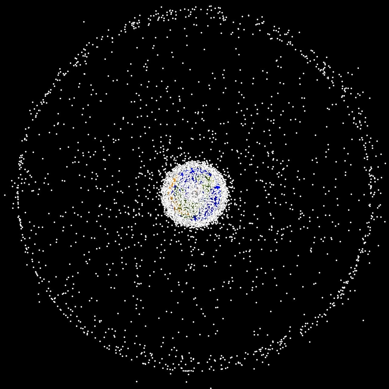
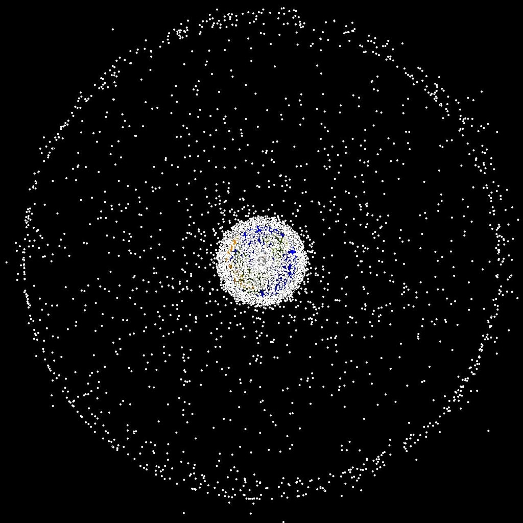
English: Debris plot by NASA The following graphics are computer generated images of objects in Earth orbit that are currently being tracked. Approximately 95% of the objects in this illustration are orbital debris, i.e., not functional satellites. The dots represent the current location of each item. The orbital debris dots are scaled according to the image size of the graphic to optimize their visibility and are not scaled to Earth. These images provide a good visualization of where the greatest orbital debris populations exist. Below are the graphics generated from different observation points. |
| Chanzo | http://orbitaldebris.jsc.nasa.gov/photogallery/beehives.html |
| Mwandishi | NASA |
Hatimiliki
| This file is in the public domain in the United States because it was solely created by NASA. NASA copyright policy states that "NASA material is not protected by copyright unless noted". (See Template:PD-USGov, NASA copyright policy page or JPL Image Use Policy.) | ||
 |
Warnings:
|
Historia ya faili
Bonyeza tarehe/saa kuona faili kama ilivyoonekana wakati huo.
| Tarehe/Saa | Picha ndogo | Vipimo | Mtumiaji | Maelezo | |
|---|---|---|---|---|---|
| sasa hivi | 16:47, 1 Februari 2005 | | 1,280 × 1,280 (146 KB) | Srbauer | debris plot by NASA |
Matumizi ya faili
Ukurasa huu umeunganishwa na faili hili:
Matumizi ya faili ulimwenguni
Wiki nyingine hutumia faili hizi:
- Matumizi kwa af.wikipedia.org
- Matumizi kwa af.wiktionary.org
- Matumizi kwa ar.wikipedia.org
- Matumizi kwa de.wikipedia.org
- Matumizi kwa hu.wikipedia.org
- Matumizi kwa it.wikipedia.org
- Matumizi kwa lb.wikipedia.org
- Matumizi kwa pt.wikipedia.org
- Matumizi kwa ru.wikipedia.org
- Matumizi kwa simple.wikipedia.org
- Matumizi kwa sv.wikipedia.org