Faili:Mali.A2001291.1045.250m.jpg

Ukubwa wa hakikisho: piseli 800 × 600. Ukubwa zingine: piseli 320 × 240 | piseli 640 × 480 | piseli 1,024 × 768 | piseli 1,280 × 960 | piseli 2,560 × 1,920 | piseli 4,000 × 3,000.
Faili halisi (piseli 4,000 × 3,000, saizi ya faili: 1.75 MB, aina ya MIME: image/jpeg)
| Faili hili linatoka Wikimedia Commons. Maelezo yapo kule kwenye ukurasa wake wa maelezo unaonekana hapo chini.
|
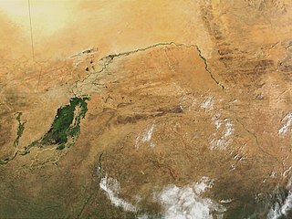
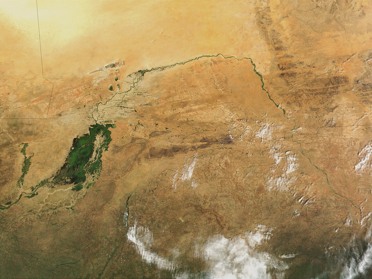
| Maelezo | Niger River in Mali, 2001. Just south of the Sahara Desert in Africa, the Niger River creates a lush area of wetlands and lakes in an otherwise arid environment. In this true-color MODIS image from October 18, 2001, the Niger enters at left as a thin strip of green and flows northeast through Mali. The river then turns south and heads into the country of Niger. (Note, this is at the end of the rainy season, showing the Niger Inland Delta in dark green). | |||||
| Tarehe |
Visualization Date 2001-10-18 |
|||||
| Chanzo | http://veimages.gsfc.nasa.gov/2243/Mali.A2001291.1045.250m.jpg | |||||
| Mwandishi | Jacques Descloitres, MODIS Land Rapid Response Team, NASA/GSFC | |||||
| Ruhusa (Kutumia faili tena) |
PD, US Gov
|

Historia ya faili
Bonyeza tarehe/saa kuona faili kama ilivyoonekana wakati huo.
| Tarehe/Saa | Picha ndogo | Vipimo | Mtumiaji | Maelezo | |
|---|---|---|---|---|---|
| sasa hivi | 22:43, 8 Machi 2008 | | 4,000 × 3,000 (1.75 MB) | T L Miles | {{Information |Description=Niger River in Mali, 2001. Just south of the Sahara Desert in Africa, the Niger River creates a lush area of wetlands and lakes in an otherwise arid environment. In this true-color MODIS image from October 18, 2001, the Niger en |
Matumizi ya faili
Ukurasa huu umeunganishwa na faili hili:
Matumizi ya faili ulimwenguni
Wiki nyingine hutumia faili hizi:
- Matumizi kwa af.wikipedia.org
- Matumizi kwa as.wikipedia.org
- Matumizi kwa bg.wikipedia.org
- Matumizi kwa ca.wikipedia.org
- Matumizi kwa cy.wikipedia.org
- Matumizi kwa en.wikipedia.org
- Matumizi kwa eo.wikipedia.org
- Matumizi kwa fr.wikipedia.org
- Matumizi kwa ilo.wikipedia.org
- Matumizi kwa ja.wikipedia.org
- Matumizi kwa la.wikipedia.org
- Matumizi kwa no.wikipedia.org
- Matumizi kwa oc.wikipedia.org
- Matumizi kwa pt.wikipedia.org
- Matumizi kwa sr.wikipedia.org
- Matumizi kwa sv.wikipedia.org
- Matumizi kwa ta.wikipedia.org
- Matumizi kwa uk.wikipedia.org
- Matumizi kwa zh.wikipedia.org