Faili:Manhattan Highlight New York City Map Julius Schorzman.png

Ukubwa wa hakikisho: piseli 616 × 600. Ukubwa zingine: piseli 247 × 240 | piseli 493 × 480 | piseli 789 × 768 | piseli 1,052 × 1,024 | piseli 2,104 × 2,048 | piseli 2,652 × 2,582.
Faili halisi (piseli 2,652 × 2,582, saizi ya faili: 4.68 MB, aina ya MIME: image/png)
| Faili hili linatoka Wikimedia Commons. Maelezo yapo kule kwenye ukurasa wake wa maelezo unaonekana hapo chini.
|
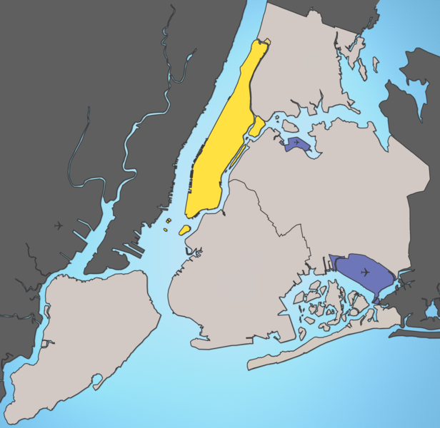
A map of New York City with Manhattan highlighted.
Notes:
- Marble Hill is shown as part Manhattan, part Bronx. See Wikipedia:Marble Hill, Manhattan, New York for more information.
- Governors Island, Ellis Island, Liberty Island, Randall's Island, and Roosevelt Island are highlighted since they are in New York County and are governmentally a part of Manhattan.
Source: I created this image using various maps and images. Attribution: Julius Schorzman
This file is licensed under the Creative Commons Attribution-Share Alike 2.5 Generic license.
- Uko huru:
- kushiriki – kunakili na kusambaza kazi hiyo
- kwa remix – kurekebisha kazi
- Chini ya masharti yafuatayo:
- sifa – Ni lazima utoe mkopo unaofaa, utoe kiungo cha leseni, na uonyeshe ikiwa mabadiliko yalifanywa. Unaweza kufanya hivyo kwa njia yoyote inayofaa, lakini si kwa njia yoyote inayopendekeza mtoa leseni akuidhinishe wewe au matumizi yako.
Historia ya faili
Bonyeza tarehe/saa kuona faili kama ilivyoonekana wakati huo.
| Tarehe/Saa | Picha ndogo | Vipimo | Mtumiaji | Maelezo | |
|---|---|---|---|---|---|
| sasa hivi | 01:59, 19 Agosti 2005 | | 2,652 × 2,582 (4.68 MB) | Quasipalm | A map of New York City with Manhattan highlighted. Notes: # '''Marble Hill''' is shown as part Manhattan, part Bronx. See wiki:Marble Hill for more information. # '''Governors Island''', '''Ellis Island''', '''Liberty Island''', '''Randall's Island' |
| 01:54, 19 Agosti 2005 |  | 2,652 × 2,582 (4.68 MB) | Quasipalm | A map of New York City with Manhattan highlighted. Notes: # '''Marble Hill''' is shown as part Manhattan, part Bronx. See wiki:Marble Hill for more information. # '''Governors Island''', '''Ellis Island''', '''Liberty Island''', '''Randall's Island' |
Matumizi ya faili
Ukurasa huu umeunganishwa na faili hili:
Matumizi ya faili ulimwenguni
Wiki nyingine hutumia faili hizi:
- Matumizi kwa bg.wikipedia.org
- Matumizi kwa bn.wikipedia.org
- Matumizi kwa bs.wikipedia.org
- Matumizi kwa ca.wikipedia.org
- Matumizi kwa de.wikipedia.org
- Matumizi kwa en.wikipedia.org
- Matumizi kwa es.wikipedia.org
- Matumizi kwa fa.wikipedia.org
- Matumizi kwa fo.wikipedia.org
- Matumizi kwa frr.wikipedia.org
- Matumizi kwa fr.wikipedia.org
- Matumizi kwa ga.wikipedia.org
- Matumizi kwa he.wikipedia.org
- Matumizi kwa hr.wikipedia.org
- Matumizi kwa hu.wikipedia.org
- Matumizi kwa id.wikipedia.org
- Matumizi kwa is.wikipedia.org
- Matumizi kwa it.wikipedia.org
- Matumizi kwa ja.wikipedia.org
- Matumizi kwa ka.wikipedia.org
- Matumizi kwa kn.wikipedia.org
- Matumizi kwa lt.wikipedia.org
- Matumizi kwa mk.wikipedia.org
- Matumizi kwa mr.wikipedia.org
- Matumizi kwa ms.wikipedia.org
- Matumizi kwa pcd.wikipedia.org
- Matumizi kwa pnb.wikipedia.org
- Matumizi kwa pt.wikipedia.org
- Matumizi kwa ro.wikipedia.org
- Matumizi kwa ru.wikipedia.org
Tazama matumizi zaidi ya kimataifa ya faili hii.