Faili:Map of Quebec-fr.png
Ukubwa wa hakikisho: piseli 569 × 600. Ukubwa zingine: piseli 228 × 240 | piseli 455 × 480.
Faili halisi (piseli 800 × 843, saizi ya faili: 1.02 MB, aina ya MIME: image/png)
| Faili hili linatoka Wikimedia Commons. Maelezo yapo kule kwenye ukurasa wake wa maelezo unaonekana hapo chini.
|
| Maelezo |
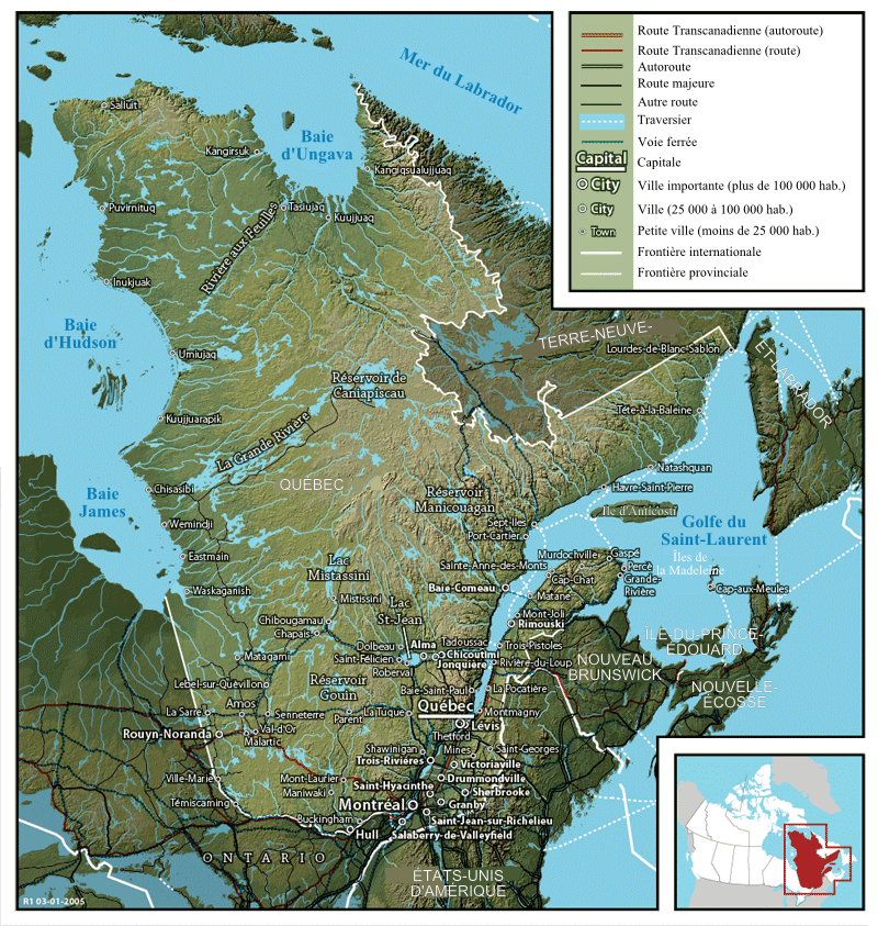
Français : Carte du Québec English: Map of Québec |
||
| Tarehe | 6 Agosti 2007 (upload date) | ||
| Chanzo | Image:Map of Quebec.png created by John Fowler, who released the image to the public domain. | ||
| Mwandishi | Modification by historicair 07:47, 6 August 2007 (UTC) / Translation by Boréal | ||
| Ruhusa (Kutumia faili tena) |
|
||
| Matoleo mengine |
Français : Version anglaise Image:Map of Quebec.png English: English version Image:Map of Quebec.png |
Historia ya faili
Bonyeza tarehe/saa kuona faili kama ilivyoonekana wakati huo.
| Tarehe/Saa | Picha ndogo | Vipimo | Mtumiaji | Maelezo | |
|---|---|---|---|---|---|
| sasa hivi | 07:47, 6 Agosti 2007 | | 800 × 843 (1.02 MB) | Historicair | {{Information |Description={{fr}}Carte du Québec (1941) {{en}}Map of Québec |Source=Image:Map of Quebec.png created by John Fowler, who released the image to the public domain. |Date=06/08/2007 |Author=Modification by ~~~~ |
Matumizi ya faili
Ukurasa huu umeunganishwa na faili hili:
Matumizi ya faili ulimwenguni
Wiki nyingine hutumia faili hizi:
- Matumizi kwa de.wikipedia.org
- Matumizi kwa fr.wikipedia.org
- Matumizi kwa hr.wikipedia.org
- Matumizi kwa mg.wikipedia.org
- Matumizi kwa pcd.wikipedia.org
- Matumizi kwa sr.wikipedia.org