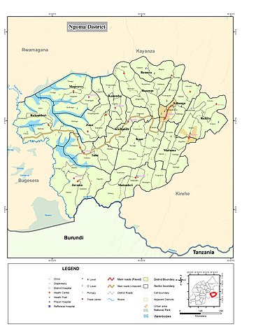
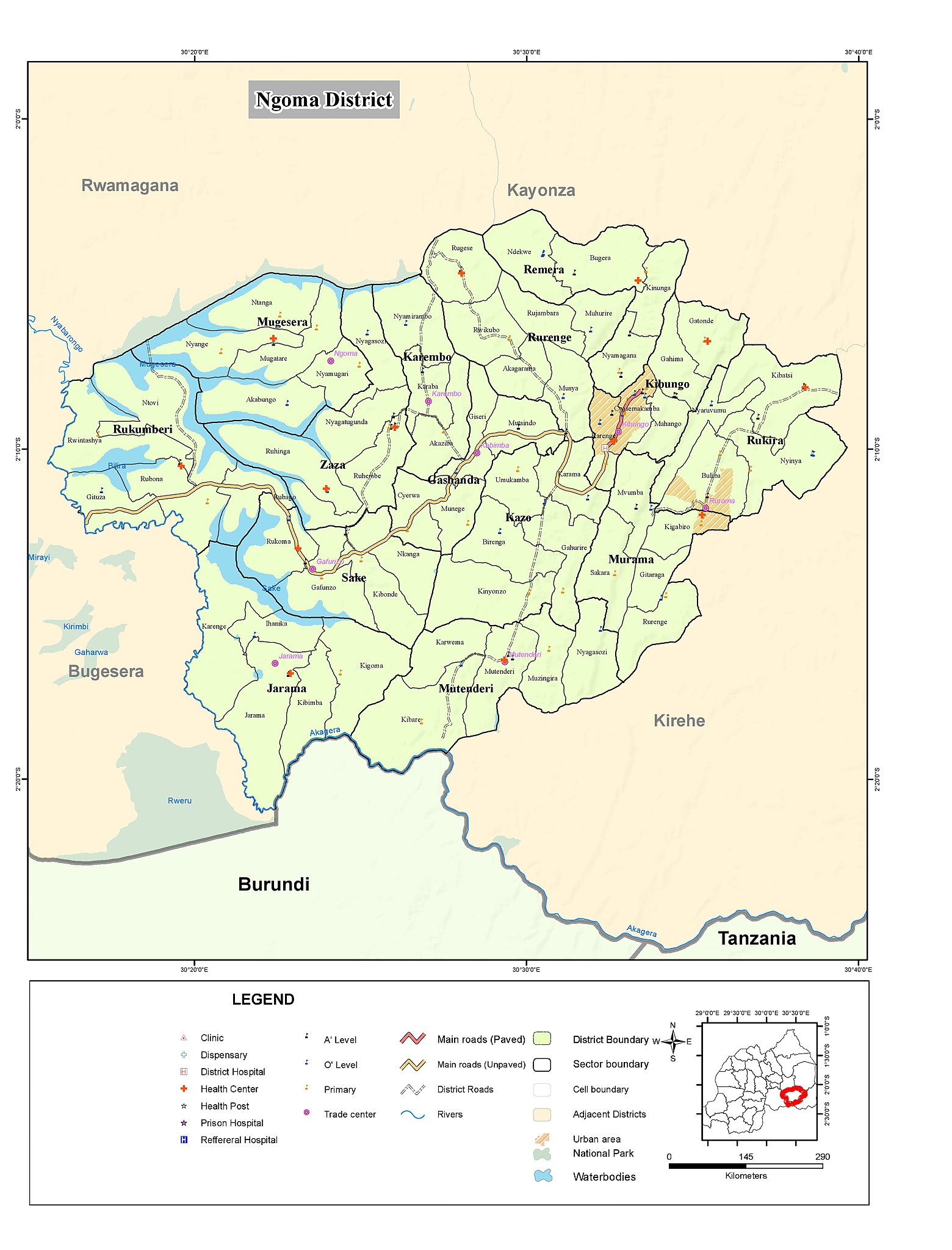
Faili:Ngoma district map.jpg

Ukubwa wa hakikisho: piseli 457 × 600. Ukubwa zingine: piseli 183 × 240 | piseli 366 × 480 | piseli 585 × 768 | piseli 780 × 1,024 | piseli 1,560 × 2,048 | piseli 3,779 × 4,960.
Faili halisi (piseli 3,779 × 4,960, saizi ya faili: 1.06 MB, aina ya MIME: image/jpeg)
| Faili hili linatoka Wikimedia Commons. Maelezo yapo kule kwenye ukurasa wake wa maelezo unaonekana hapo chini.
|
Muhtasari
| Maelezo |
Nederlands: Kaart van district Ngoma Rwanda
English: Map of Ngoma district Rwanda |
| Tarehe | |
| Chanzo | http://geodata-nisr-rwanda.opendata.arcgis.com/datasets/ed281d2205224d138d9307163cab184f |
| Mwandishi | National Institute of Statistics Rwanda |
Hatimiliki
| This work has been released into the public domain by its author, National Institute of Statistics Rwanda. This applies worldwide. Katika nchi zingine hii haiwezekani kisheria; kama ni hivyo: National Institute of Statistics Rwanda grants anyone the right to use this work for any purpose, without any conditions, unless such conditions are required by law.
|
Historia ya faili
Bonyeza tarehe/saa kuona faili kama ilivyoonekana wakati huo.
| Tarehe/Saa | Picha ndogo | Vipimo | Mtumiaji | Maelezo | |
|---|---|---|---|---|---|
| sasa hivi | 11:20, 21 Agosti 2019 | | 3,779 × 4,960 (1.06 MB) | Kevin 990 | User created page with UploadWizard |
Matumizi ya faili
Ukurasa huu umeunganishwa na faili hili:
Matumizi ya faili ulimwenguni
Wiki nyingine hutumia faili hizi:
- Matumizi kwa de.wikipedia.org
- Matumizi kwa nl.wikipedia.org
- Matumizi kwa rw.wikipedia.org