Faili:Seto Inland Sea satellite.jpg

Ukubwa wa hakikisho: piseli 800 × 544. Ukubwa zingine: piseli 320 × 218 | piseli 640 × 435 | piseli 1,024 × 696.
Faili halisi (piseli 1,024 × 696, saizi ya faili: 242 KB, aina ya MIME: image/jpeg)
| Faili hili linatoka Wikimedia Commons. Maelezo yapo kule kwenye ukurasa wake wa maelezo unaonekana hapo chini.
|
| Maelezo |
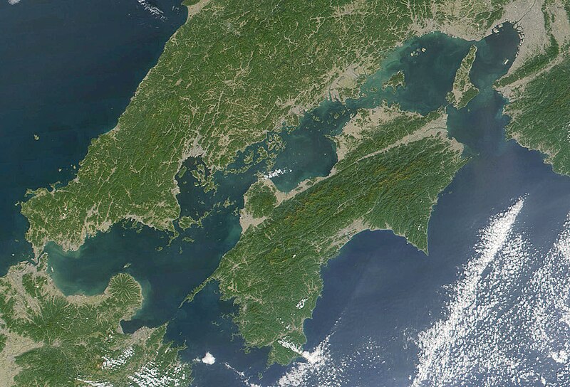
日本語: 瀬戸内海 Seto-naikai
Deutsch: Die Seto-Inlandsee ist ein Binnenmeer das die japanischen Inseln Honshū, Shikoku und Kyūshū voneinander trennt.
English: Formally named the Seto Inland Sea, the Inland Sea is the body of water separating Honshū, Shikoku, two of the main islands of Japan, and Kyūshū. |
| Tarehe | |
| Chanzo | Cropped from: http://visibleearth.nasa.gov/view_rec.php?id=2206 |
| Mwandishi | Jacques Descloitres, MODIS Land Rapid Response Team, NASA/GSFC |
| This file is in the public domain in the United States because it was solely created by NASA. NASA copyright policy states that "NASA material is not protected by copyright unless noted". (See Template:PD-USGov, NASA copyright policy page or JPL Image Use Policy.) | ||
 |
Warnings:
|
Historia ya faili
Bonyeza tarehe/saa kuona faili kama ilivyoonekana wakati huo.
| Tarehe/Saa | Picha ndogo | Vipimo | Mtumiaji | Maelezo | |
|---|---|---|---|---|---|
| sasa hivi | 21:21, 22 Novemba 2004 | | 1,024 × 696 (242 KB) | Tsui | Japan, the Seto inland-lake |
Matumizi ya faili
Hakuna kurasa zozote zinazotumia faili hii.
Matumizi ya faili ulimwenguni
Wiki nyingine hutumia faili hizi:
- Matumizi kwa en.wikipedia.org
- Matumizi kwa fr.wikipedia.org
- Matumizi kwa it.wikivoyage.org
- Matumizi kwa ja.wikipedia.org
- Matumizi kwa ja.wikibooks.org
- Matumizi kwa ko.wikipedia.org
- Matumizi kwa pl.wiktionary.org
- Matumizi kwa tr.wikipedia.org
- Matumizi kwa www.wikidata.org
- Matumizi kwa wuu.wikipedia.org
- Matumizi kwa zh-classical.wikipedia.org
- Matumizi kwa zh-min-nan.wikipedia.org
- Matumizi kwa zh.wikipedia.org