Faili:Tanzania map-fr.svg

Faili halisi(faili la SVG, husemwa kuwa piseli 2,064 × 2,075, saizi ya faili: 3.15 MB)

Faili hili linatoka Wikimedia Commons. Maelezo yapo kule kwenye ukurasa wake wa maelezo unaonekana hapo chini.
Commons ni mahali mtandaoni pa kuhifadhia jalada na hati za picha na sauti zenye leseni huria. Unaweza kuisadia.

Muhtasari

Description
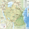
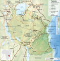
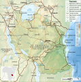
English: Map of Tanzania in French.
Equirectangular projection. 1° N, 28° W, 42° E, -13° S. Center : -6.375, 35
Español: Mapa de Tanzania en francés.
Proyección cilíndrica equidistante. 1° N, 28° O, 42° E, -13° S. Centro : -6.375, 35
Français : Carte de la Tanzanie en français.
Projection cylindrique équidistante. 1° N, 28° O, 42° E, -13° S. Centre : -6.375, 35
日本語: フランス語版タンザニアの地図。
等角投影図。1° N, 28° O, 42° E, -13° S. 中心点 : -6.375, 35
Tarehe
Chanzo
  • Elevations : NASA SRTM3 (public domain)
  • Shores : NASA SWBD (public domain)
  • Bathymetry : NGDC ETOPO1 (public domain)
  • Boundaries, roads & rails : NGDC World Data Bank II (public domain);
  • Towns, roads & airports : United Nations, Department of Peacekeeping Operations, Cartographic Section (public domain). Maps :
    • Tanzania : No. 3667 Rev. 5, January 2005
    • Kenya : No. 4187 Rev. 1, January 2004
    • Rd Congo : No. 4007 Rev. 8, January 2004
    • Zambia : No. 3731 Rev. 4, January 2004
Muumbaji
Georeferencing Georeference the map in Wikimaps Warper If inappropriate please set warp_status = skip to hide.
Matoleo mengine

[hariri]

Sifa
(required by the license)
InfoField
© Sémhur / Wikimedia Commons / 
© Sémhur / Wikimedia Commons
Assessments
InfoField
Picha of the year
Picha of the year
Featured Picha

Wikimedia Commons

This is a featured picture on Wikimedia Commons (Featured pictures) and is considered one of the finest images. See its nomination here.

If you have an image of similar quality that can be published under a suitable copyright license, be sure to upload it, tag it, and nominate it.

SVG
InfoField
 
W3C-validity not checked.
 
This W3C-unspecified vector image was created with Inkscape…important .
Translate this file This SVG file contains embedded text that can be translated into your language, using any capable SVG editor, text editor or the SVG Translate tool. For more information see: About translating SVG files.
Graphic Lab
InfoField
Object location6° 00′ 00″ S, 34° 30′ 00″ E  Heading=0° Kartographer map based on OpenStreetMap.View this and other nearby images on: OpenStreetMapinfo

Hatimiliki

I, the copyright holder of this work, hereby publish it under the following licenses:
Licence Art Libre Copyleft: This work of art is free; you can redistribute it and/or modify it according to terms of the Free Art License. You will find a specimen of this license on the Copyleft Attitude site as well as on other sites.
w:en:Creative Commons
sifa shiriki sawa
This file is licensed under the Creative Commons Attribution-Share Alike 4.0 International, 3.0 Unported, 2.5 Generic, 2.0 Generic and 1.0 Generic license.
Uko huru:
  • kushiriki – kunakili na kusambaza kazi hiyo
  • kwa remix – kurekebisha kazi
Chini ya masharti yafuatayo:
  • sifa – Ni lazima utoe mkopo unaofaa, utoe kiungo cha leseni, na uonyeshe ikiwa mabadiliko yalifanywa. Unaweza kufanya hivyo kwa njia yoyote inayofaa, lakini si kwa njia yoyote inayopendekeza mtoa leseni akuidhinishe wewe au matumizi yako.
shiriki sawa – Ukichanganya, kubadilisha, au kujenga juu ya nyenzo, lazima usambaze michango yako chini ya same or compatible license kama ya awali.
Unaweza kuchagua leseni ya chaguo lako.

Captions

Add a one-line explanation of what this file represents

Items portrayed in this file

depicts Kiingereza

copyright status Kiingereza

copyrighted Kiingereza

19 Machi 2008

6°S, 35°E

heading Kiingereza: 0 nyuzi

Historia ya faili

Bonyeza tarehe/saa kuona faili kama ilivyoonekana wakati huo.

Tarehe/SaaPicha ndogoVipimoMtumiajiMaelezo
sasa hivi13:08, 6 Mei 2009Picha ndogo ya toleo la 13:08, 6 Mei 20092,064 × 2,075 (3.15 MB)Sémhursmaller size (2/3)
13:30, 20 Machi 2009Picha ndogo ya toleo la 13:30, 20 Machi 20093,096 × 3,113 (3.08 MB)SémhurOl Doinyo Lengaï was misplaced
11:14, 20 Machi 2009Picha ndogo ya toleo la 11:14, 20 Machi 20093,096 × 3,113 (3.07 MB)SémhurAdd location map and few summits.
17:14, 19 Machi 2009Picha ndogo ya toleo la 17:14, 19 Machi 20093,096 × 3,113 (2.96 MB)Sémhurgrrr...
17:08, 19 Machi 2009Picha ndogo ya toleo la 17:08, 19 Machi 20093,096 × 3,113 (2.96 MB)SémhurOups ! It wasn't the valid one.
17:05, 19 Machi 2009Picha ndogo ya toleo la 17:05, 19 Machi 20093,096 × 3,113 (2.98 MB)Sémhur{{Information |Description={{en|1=Map of en:Tanzania.}} {{fr|1=Carte de la fr:Tanzanie.}} {{es|1=Mapa de es:Tanzania.}} |Source=travail personnel (own work). Sources of data: * Elevations : NASA SRTM3 (public domain) * Shores : NASA SWBD (p

Ukurasa huu umeunganishwa na faili hili:

Matumizi ya faili ulimwenguni

Wiki nyingine hutumia faili hizi:

Tazama matumizi zaidi ya kimataifa ya faili hii.

Data juu