Faili:Uganda location map.svg

Faili halisi (faili la SVG, husemwa kuwa piseli 1,441 × 1,466, saizi ya faili: 431 KB)
| Faili hili linatoka Wikimedia Commons. Maelezo yapo kule kwenye ukurasa wake wa maelezo unaonekana hapo chini.
|
Muhtasari
| Maelezo |
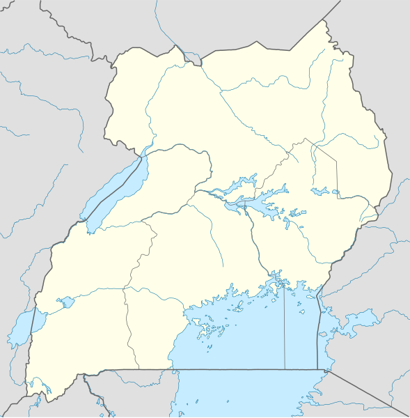
Deutsch: Positionskarte von Uganda
Quadratische Plattkarte. Geographische Begrenzung der Karte:
English: Location map of Uganda
Equirectangular projection. Geographic limits of the map:
|
|
| Tarehe | ||
| Chanzo |
Kazi yangu, using
|
|
| Mwandishi | NordNordWest | |
| Ruhusa (Kutumia faili tena) |
This file is licensed under the Creative Commons Attribution-Share Alike 3.0 Germany license.
 This file is licensed under the Creative Commons Attribution-Share Alike 3.0 Germany license.
|
|
| Matoleo mengine |
Derivative works of this file: Uganda location map Topographic.png |


|
This map has been made or improved in the German Kartenwerkstatt (Map Lab). You can propose maps to improve as well.
|
Historia ya faili
Bonyeza tarehe/saa kuona faili kama ilivyoonekana wakati huo.
| Tarehe/Saa | Picha ndogo | Vipimo | Mtumiaji | Maelezo | |
|---|---|---|---|---|---|
| sasa hivi | 19:25, 1 Desemba 2009 | | 1,441 × 1,466 (431 KB) | NordNordWest | =={{int:filedesc}}== {{Information |Description= {{de|Positionskarte von Uganda}} Quadratische Plattkarte. Geographische Begrenzung der Karte: * N: 4.5° N * S: 1.7° S * W: 29.2° O * O: 35.3° O {{en|Location map of Uganda} |
Matumizi ya faili
Zipo kurasa zaidi ya 100 zinazounga na faili hili. Orodha inayofuata inaonyesha viungo 100 vya kwanza tu vinavyoungana na faili hili. Orodha nzima inapatikana.
- Abim
- Adjumani
- Amolatar
- Amuria
- Amuru
- Apac
- Arapai
- Arua
- Atiak
- Atutur Town
- Bamunanika
- Banga, Entebbe
- Bbaale
- Bibia
- Bihanga
- Bobi, Uganda
- Budaka
- Bududa
- Bugamba
- Bugembe
- Bugiri
- Bugongi, Kabale, Uganda
- Bugongi, Sheema, Uganda
- Buikwe
- Bukedea
- Bukungu (Uganda)
- Bukwa
- Bundibugyo
- Bushenyi
- Busia, Uganda
- Buwama
- Bwamiramira
- Bweyogerere
- Entebbe
- Galilaya (Uganda)
- Gayaza
- Gombe, Butambala
- Gombe, Wakiso
- Hima
- Iganga
- Ishaka
- Itega
- Kabamba, Uganda
- Kakira
- Kakumiro
- Kakuuto, Uganda
- Kalagala
- Kalagi, Mubende
- Kalagi, Mukono
- Kampala
- Kasese
- Katunguru, Uganda
- Kibaale
- Kisoro
- Kitgum
- Koboko
- Kotido
- Kumi (Uganda)
- Kyenjojo
- Lira, Uganda
- Luweero
- Lyantonde
- Manafwa
- Masaka (Uganda)
- Masindi
- Mayuge
- Mbarara
- Mityana
- Moroto
- Mpigi
- Mubende
- Mubuku
- Mukono
- Musita
- Nakapiripirit
- Nakaseke
- Nakasongola
- Namataba
- Namulonge
- Namutumba
- Nansana
- Nebbi
- Ngogwe (manispaa)
- Ntungamo
- Ombaci
- Oyam
- Pader
- Pallisa
- Rakai
- Rukungiri
- Sembabule
- Semuto
- Sironko
- Sonde, Uganda
- Soroti
- Ssabagabo
- Tororo
- Wakiso
- Wobulenzi
- Yumbe
Tazama viungo vingine vinavyoelekeza faili hili.
Matumizi ya faili ulimwenguni
Wiki nyingine hutumia faili hizi:
- Matumizi kwa af.wikipedia.org
- Matumizi kwa am.wikipedia.org
- Matumizi kwa an.wikipedia.org
- Matumizi kwa ar.wikipedia.org
- Matumizi kwa ast.wikipedia.org
- Matumizi kwa av.wikipedia.org
- Matumizi kwa azb.wikipedia.org
- Matumizi kwa az.wikipedia.org
- Matumizi kwa be-tarask.wikipedia.org
- Matumizi kwa be.wikipedia.org
Tazama matumizi zaidi ya kimataifa ya faili hii.