Faili:Africa-asia-america-to-scale.jpg
Ukubwa wa hakikisho: piseli 800 × 267. Ukubwa zingine: piseli 320 × 107 | piseli 1,200 × 400.
Faili halisi (piseli 1,200 × 400, saizi ya faili: 223 KB, aina ya MIME: image/jpeg)
| Faili hili linatoka Wikimedia Commons. Maelezo yapo kule kwenye ukurasa wake wa maelezo unaonekana hapo chini.
|
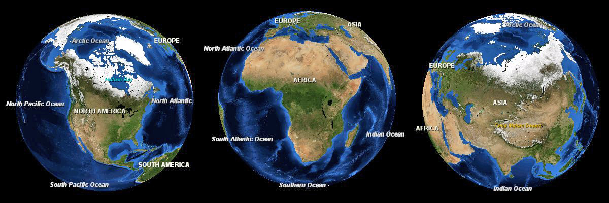
| Maelezo |
English: Three images of the Earth showing North America, Africa and Eurasia to scale. |
|||
| Tarehe | ||||
| Chanzo | NASA World Wind | |||
| Mwandishi | Andrew Oakley | |||
| Ruhusa (Kutumia faili tena) |
|

Historia ya faili
Bonyeza tarehe/saa kuona faili kama ilivyoonekana wakati huo.
| Tarehe/Saa | Picha ndogo | Vipimo | Mtumiaji | Maelezo | |
|---|---|---|---|---|---|
| sasa hivi | 20:57, 4 Januari 2012 | 1,200 × 400 (223 KB) | Soerfm | Brightness | |
| 13:53, 13 Oktoba 2008 | 1,200 × 400 (103 KB) | Evilandi | {{Information |Description={{en|1=Three images of the Earth showing North America, Africa and Asia to scale.}} |Source=NASA World Wind |Author=Andrew Oakley |Date=2008-10-13 |Permission={{PD-WorldWind}} |other_versions= }} <!--{{ImageUpload|full}}--> |
Matumizi ya faili
Kurasa hizi 2 zimeunganishwa na faili hili:
Matumizi ya faili ulimwenguni
Wiki nyingine hutumia faili hizi:
- Matumizi kwa gl.wikipedia.org
- Matumizi kwa it.wikipedia.org
- Matumizi kwa my.wikipedia.org
- Matumizi kwa os.wikipedia.org
- Matumizi kwa sa.wikipedia.org
- Matumizi kwa sd.wikipedia.org
- Matumizi kwa tr.wikipedia.org