Faili:UAE divisions.jpg
Hakuna saizi kubwa zaidi.
UAE_divisions.jpg (piseli 617 × 496, saizi ya faili: 96 KB, aina ya MIME: image/jpeg)
| Faili hili linatoka Wikimedia Commons. Maelezo yapo kule kwenye ukurasa wake wa maelezo unaonekana hapo chini.
|
Muhtasari

|
This locator map image could be re-created using vector graphics as an SVG file. This has several advantages; see Commons:Media for cleanup for more information. If an SVG form of this image is available, please upload it and afterwards replace this template with
{{vector version available|new image name}}.
It is recommended to name the SVG file “UAE divisions.svg”—then the template Vector version available (or Vva) does not need the new image name parameter. |


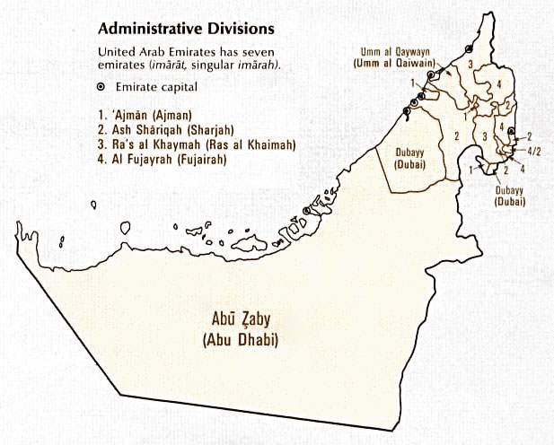
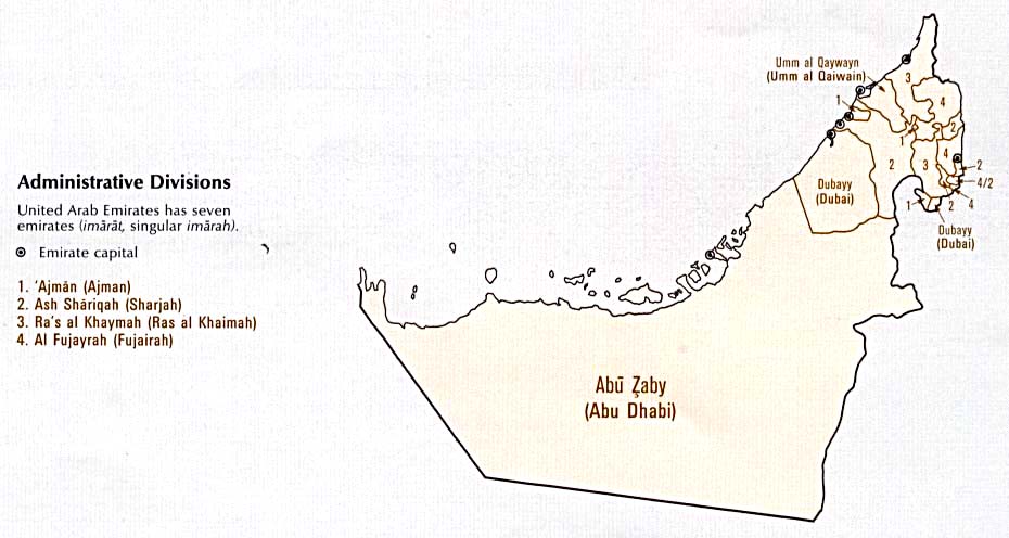
| Maelezo | A map showing the seven Emirates of the United Arab Emirates. |
| Tarehe | published January 1993 |
| Chanzo |
Digital file: http://www.lib.utexas.edu/maps/atlas_middle_east/uae_division.jpg |
| Mwandishi | U.S. Central Intelligence Agency |
| Ruhusa (Kutumia faili tena) |
Public domain |
Hatimiliki
| This image is a work of a Central Intelligence Agency employee, taken or made as part of that person's official duties. As a Work of the United States Government, this image or media is in the public domain in the United States.
|

|
Historia ya faili
Bonyeza tarehe/saa kuona faili kama ilivyoonekana wakati huo.
| Tarehe/Saa | Picha ndogo | Vipimo | Mtumiaji | Maelezo | |
|---|---|---|---|---|---|
| sasa hivi | 12:38, 27 Oktoba 2006 | | 617 × 496 (96 KB) | Conscious | newest version from en: |
| 10:53, 6 Septemba 2005 |  | 930 × 496 (61 KB) | Thryduulf | A map showing the seven Emirates of the United Arab Emirates. Source is [http://www.lib.utexas.edu/maps/atlas_middle_east/uae_division.jpg] which states that "These maps and charts are scanned from ''Atlas of the Middle East'', published in January 1 |
Matumizi ya faili
Hakuna kurasa zozote zinazotumia faili hii.
Matumizi ya faili ulimwenguni
Wiki nyingine hutumia faili hizi:
- Matumizi kwa azb.wikipedia.org
- Matumizi kwa de.wikipedia.org
- Matumizi kwa en.wikipedia.org
- Matumizi kwa nl.wikipedia.org
- Matumizi kwa sq.wikipedia.org